Sandy Hook Marine Forecast, NJ
Updated Tue Sep 29, 2026
Three straight GO days with calm winds and gentle seas
Drop a pin on any spot in the world — free in the SeaLegs AI app.


Marine Forecast for Sandy Hook Sep 29 – Oct 1, 2026
📋 Three straight GO days with calm winds and gentle seas
A great day on the water with light 1-7 knots west winds and gentle 1.1-1.4 feet seas at 7-second periods from the ESE. Visibility is excellent and no rain is expected, making any time of day workable.
Another easy GO day with light 1-7 knots east winds and small 1.1-1.4 feet seas at 8-second periods from the ESE. Clear skies and calm conditions make this a comfortable day to be out anytime.
Conditions stay favorable with 5-9 knots SSW winds and gentle 1.1-1.4 feet seas at 8-second periods from the ESE. Good visibility and dry weather round out a solid all-day GO.
Tuesday 12:00 AM to 11:00 AM offers the calmest stretch, with light 4 knots west winds and smooth 1.4 feet seas at 7-second periods from the ESE.
Recent days at Sandy Hook
Today’s Water at Sandy Hook
Sea surface temperature and chlorophyll around Sandy Hook, imaged fresh every morning. Water at the star is 67.0°F today, and chlorophyll of 3.94 mg/m³ reads as nutrient-rich green water at the spot.
Imagery: Sep 29, 2026 · rebuilt every morning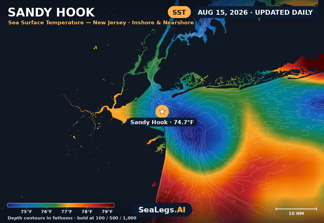
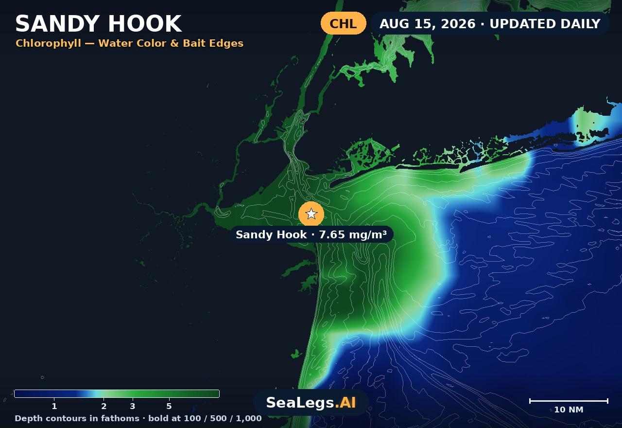
These charts show you the breaks. DeepCast reads them. A zone-by-zone AI fishing report for these exact waters — temperature edges, color changes, and structure, analyzed together.
Get the AI fishing reportSST and chlorophyll from the SeaLegs AI DeepCast satellite pipeline. Charts are a planning aid — always check the official marine forecast before making the run.
About Sandy Hook
Sandy Hook is the northern gateway to the Jersey Shore — a six-mile barrier spit at the entrance to Lower New York Bay, with the Atlantic on one side, Sandy Hook Bay and Raritan Bay on the other, and some of the busiest recreational water in the Northeast in between. It is also the name boaters know from the NOAA zone forecast — the coastal waters from Sandy Hook to Manasquan Inlet — which is why the Hook is the reference point for anyone deciding whether to run the oceanfront or stay inside the bay.
The outlook below updates every morning from the latest marine model data, and each day gets an honest GO, CAUTION, or NO-GO call — the same AI rating used in the SeaLegs AI app.
Reading conditions at Sandy Hook
The water around the Hook changes character fast. The tip is a tide rip: current pouring in and out of New York Harbor meets ocean swell over shoal water, and an ebb tide against an onshore wind stands seas up steep and close right where small boats round the point. A forecast that reads manageable for the open beachfront can still mean a rough, wet ride at the rips and across the shoals toward the shipping channels — so weight the wave period as heavily as the height, and time the tip for slack water when the wind is up.
The Hook also gives you an out that pure oceanfront ports don't have: when the Atlantic side is a NO-GO, Sandy Hook Bay and Raritan Bay often stay fishable in everything but a hard north or northeast blow. Use the three-day view above to make that call — run the ocean on the day the window stays open, and work the bay side when it doesn't.
Sandy Hook forecast FAQ
How is the sea at Sandy Hook today?
As of Sep 29, 2026, the SeaLegs AI verdict for Sandy Hook is GO. A great day on the water with light 1-7 knots west winds and gentle 1.1-1.4 feet seas at 7-second periods from the ESE. Visibility is excellent and no rain is expected, making any time of day workable.
What marine forecast zone covers Sandy Hook?
NOAA's coastal waters forecast for this stretch covers Sandy Hook to Manasquan Inlet, out 20 nautical miles. The forecast on this page is built for the Sandy Hook area itself — the tip of the Hook, the beachfront, and the approaches to Sandy Hook Bay and Raritan Bay.
How often is this Sandy Hook forecast updated?
The forecast on this page is rebuilt every morning from the latest marine model data, and the SpotCast card refreshes live in your browser. The date stamp above the outlook shows exactly when it was last generated.
What do GO, CAUTION, and NO-GO mean?
GO means conditions are favorable for most recreational boats. CAUTION means marginal — manageable for experienced crews in capable vessels, but check the wind and wave timing closely. NO-GO means conditions are hazardous for small craft and the trip is best postponed.
Can I get a forecast like this for my own spot?
Yes. In the free SeaLegs AI app you can drop a pin on any spot on Earth — your favorite bay pocket, a nearshore lump, or an offshore canyon — and get the same AI-rated marine forecast, plus fishing reports and trip planning.
What is the water temperature at Sandy Hook today?
As of Sep 29, 2026, the satellite-derived sea surface temperature at Sandy Hook is about 67.0°F, with chlorophyll around 3.94 mg/m³ (nutrient-rich green water). The SST and chlorophyll charts on this page are rebuilt every morning from the SeaLegs AI DeepCast satellite pipeline.
More offshore forecasts
Get this forecast for your own spot
Drop a pin on any spot on planet Earth in the free SeaLegs AI app — AI marine forecasts, fishing reports, and trip planning, rated GO / CAUTION / NO-GO.
📍 Get a Marine Forecast Near You →or download directly: