Halifax Marine Forecast
Updated Sat Sep 12, 2026
Deteriorating through Monday's steep chop; only Saturday looks solid
Drop a pin on any spot in the world — free in the SeaLegs AI app.


Marine Forecast for Halifax Approaches Sep 12–14, 2026
📋 Deteriorating through Monday's steep chop; only Saturday looks solid
Overnight chop with 4-5 feet seas eases by mid-morning into calm, well-organized 2.6-3.0 feet seas at 6-second periods and light 5-10 knot winds. Best window is 10:00 AM-6:00 PM. Use caution before dawn when seas are still building down from overnight peak.
Moderate 12-15 knot S/SSW winds with 2.9-3.4 feet seas, but periods shorten to 4 seconds midday creating steeper, choppier conditions for about 5 hours. Morning is the more comfortable window; late evening starts trending toward Monday's rougher setup.
Unsafe conditions with steep 4-5 feet chop at only 4-5 second periods, 16-19 knot winds gusting to 24 knots, and 0.62in of rain. A confused cross-sea develops overnight as SSE swell meets the wind-wave from another direction, producing uncomfortable, unpredictable motion. This is a NO-GO day - avoid boating entirely.
Saturday offers the best boating window with light winds and organized swell, but conditions steadily deteriorate through the weekend into Monday when steep wind-wave chop, rain, and a confused cross-sea make the water unsafe for recreational vessels. Overall this three-day period is a NO-GO due to Monday's hazardous combination of wave steepness and precipitation.
Recent days at Halifax Approaches
Today’s Water at Halifax Approaches
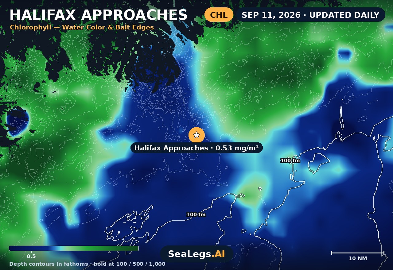
Sea surface temperature and chlorophyll around Halifax Approaches, imaged fresh every morning. Water at the star is 63.3°F today, and chlorophyll of 0.53 mg/m³ reads as green shelf water at the spot.
Imagery: Sep 11, 2026 · rebuilt every morning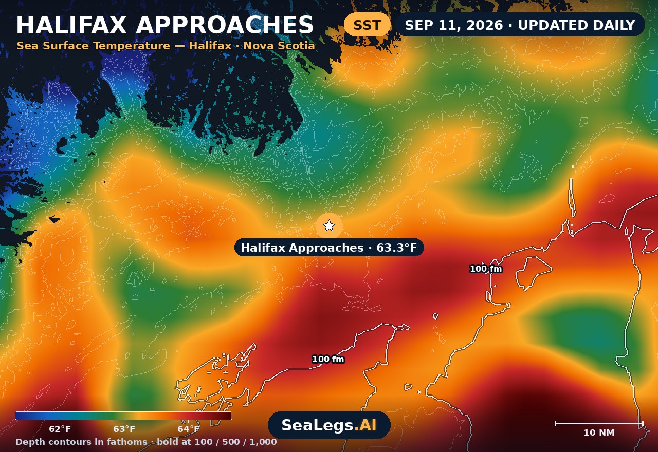
These charts show you the breaks. DeepCast reads them. A zone-by-zone AI fishing report for these exact waters — temperature edges, color changes, and structure, analyzed together — for $4.99.
Get the AI fishing reportSST and chlorophyll from the SeaLegs AI DeepCast satellite pipeline. Charts are a planning aid — always check the official marine forecast before making the run.
About the Halifax approaches
This forecast covers the Halifax approaches — the open Atlantic water south of Chebucto Head, about 22 km beyond the headland and 26 km outside the harbour mouth. The harbour itself is well sheltered; the approaches are not, and it is the swell out here that decides most trips.
It updates every morning from the latest marine model data, and each day gets an honest GO, CAUTION, or NO-GO call — the same AI rating used in the SeaLegs AI app.
Reading the Halifax approaches
Halifax sits on an open Atlantic coast with nothing between it and the deep ocean to the southeast, so unlike a sheltered strait this water carries genuine long-period swell. Swell can be running here in near-calm local wind — a still morning at the waterfront tells you very little about the sea state past Chebucto Head, which is the single most common way a Halifax trip goes wrong.
The pattern to respect is the southeasterly: it has open ocean fetch behind it and pushes swell straight into the approaches. Ebb tide running out of the harbour against an incoming sea stands things up at the mouth, so time the entrance as carefully as the run. From late summer into autumn, the remains of tropical systems tracking up the eastern seaboard can put large swell on this coast well before any local wind arrives — watch the period, not just the height.
This page is a planning aid, not a substitute for Environment Canada's marine forecasts and warnings — always check those before you leave the dock.
Halifax Approaches forecast FAQ
How is the sea at Halifax Approaches today?
As of Sep 12, 2026, the SeaLegs AI verdict for Halifax Approaches is CAUTION. Saturday is a solid CAUTION day that turns into the best window of the period once early chop clears. Overnight into early morning still carries leftover 3.5-4.7 feet seas at 6-second periods from the SW with 13-15 knot NW winds gusting to 21 knots, but by mid-morning winds ease to 5-10 knots and seas settle to a comfortable 2.6-3.0 feet at 6-second periods from the SW/SSW. The window from 10:00 AM to 6:00 PM offers the calmest, most organized conditions of the entire forecast, though caution is warranted overnight due to lingering chop.
Does this forecast cover Halifax Harbour itself?
No — deliberately. The forecast point sits in the open approaches roughly 26 km south of the harbour mouth, and about 22 km beyond Chebucto Head, because that's the water that decides whether a trip is on. The harbour is considerably more sheltered, and a forecast placed inside it would tell you very little about what you'd meet once you cleared the head.
Why can the sea be rough off Halifax on a calm day?
Because this is an open Atlantic coast with long fetch to the southeast, swell generated by distant weather arrives independently of local wind. It's entirely normal to have a still morning ashore and a significant swell running in the approaches, which is why the wave period on this page matters as much as the wind.
When are conditions worst off Halifax?
Southeasterly winds are the pattern to watch, since they carry open ocean fetch straight into the approaches. From late summer into autumn, the remnants of tropical systems moving up the eastern seaboard can also put heavy swell on this coast ahead of any local wind.
How often is this forecast updated?
The page is rebuilt every morning from the latest model run, and the SpotCast card refreshes live in your browser. The date stamp above the outlook shows when it was last generated.
What do GO, CAUTION, and NO-GO mean?
GO means conditions are favourable for most recreational boats. CAUTION means marginal — manageable for experienced crews in capable vessels, but check the wind and sea timing closely. NO-GO means conditions are hazardous for small craft and the trip is best postponed.
What is the water temperature at Halifax Approaches today?
As of Sep 11, 2026, the satellite-derived sea surface temperature at Halifax Approaches is about 63.3°F, with chlorophyll around 0.53 mg/m³ (green shelf water). The SST and chlorophyll charts on this page are rebuilt every morning from the SeaLegs AI DeepCast satellite pipeline.
More offshore forecasts
Get this forecast for your own spot
Drop a pin on any spot on planet Earth in the free SeaLegs AI app — AI marine forecasts, fishing reports, and trip planning, rated GO / CAUTION / NO-GO.
📍 Get a Marine Forecast Near You →or download directly: