Hudson Canyon Marine Forecast
Updated Mon Oct 19, 2026
NO-GO: strong NNE winds and big seas all 3 days
Drop a pin on any spot in the world — free in the SeaLegs AI app.


Marine Forecast for Hudson Canyon Oct 19–21, 2026
📋 NO-GO: strong NNE winds and big seas all 3 days
NO-GO. Northeast winds of 19 to 26 knots with gusts to 36 knots, and east seas of 7 to 13 feet at 8-second periods. Winds ease only slightly in the early hours, then turn bad again from 2:00 PM onward. No settled stretch is long enough for a 12-hour trip.
NO-GO. North-northeast winds of 24 to 29 knots with gusts to 40 knots, and east-northeast seas of 12 to 13 feet at 8-second periods. A steep wind-wave chop for 6 hours and a confused cross-sea for 5 hours, with east swell crossing the northeast wind-wave, make for awkward, uncomfortable motion with no good heading. Stay in port.
NO-GO. North-northeast winds of 21 to 29 knots with gusts to 40 knots, and east-northeast seas of 13 to 14 feet at 8-second periods. Winds stay in the bad range until the late evening and the seas never ease, so there is no time to go.
No acceptable window exists for a 12-hour trip in this forecast, as every day brings strong winds and 7 to 14 foot seas.
Recent days at Hudson Canyon
Today’s Water at Hudson Canyon
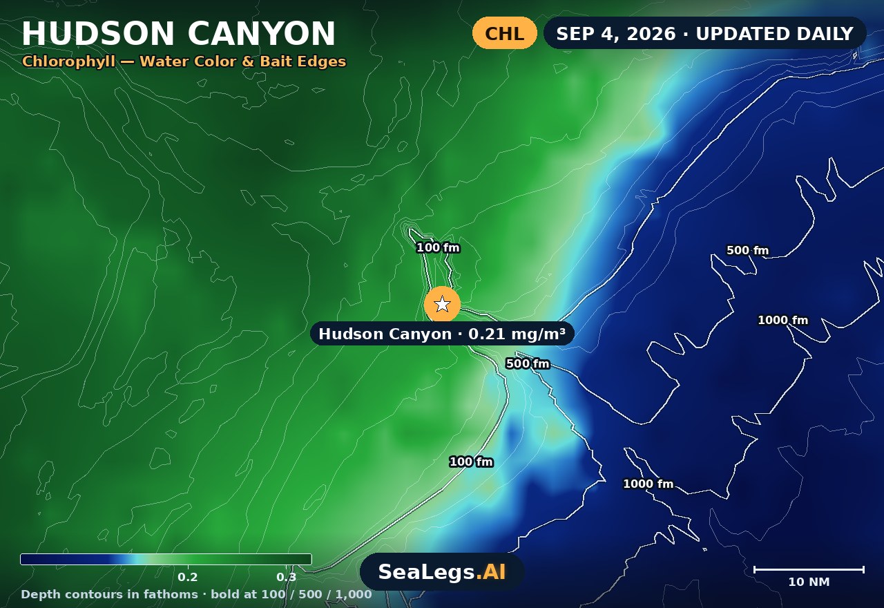
Sea surface temperature and chlorophyll around Hudson Canyon, imaged fresh every morning. Water at the star is 70.3°F today, and chlorophyll of 0.29 mg/m³ reads as blue-green transition water at the spot.
Imagery: Oct 19, 2026 · rebuilt every morning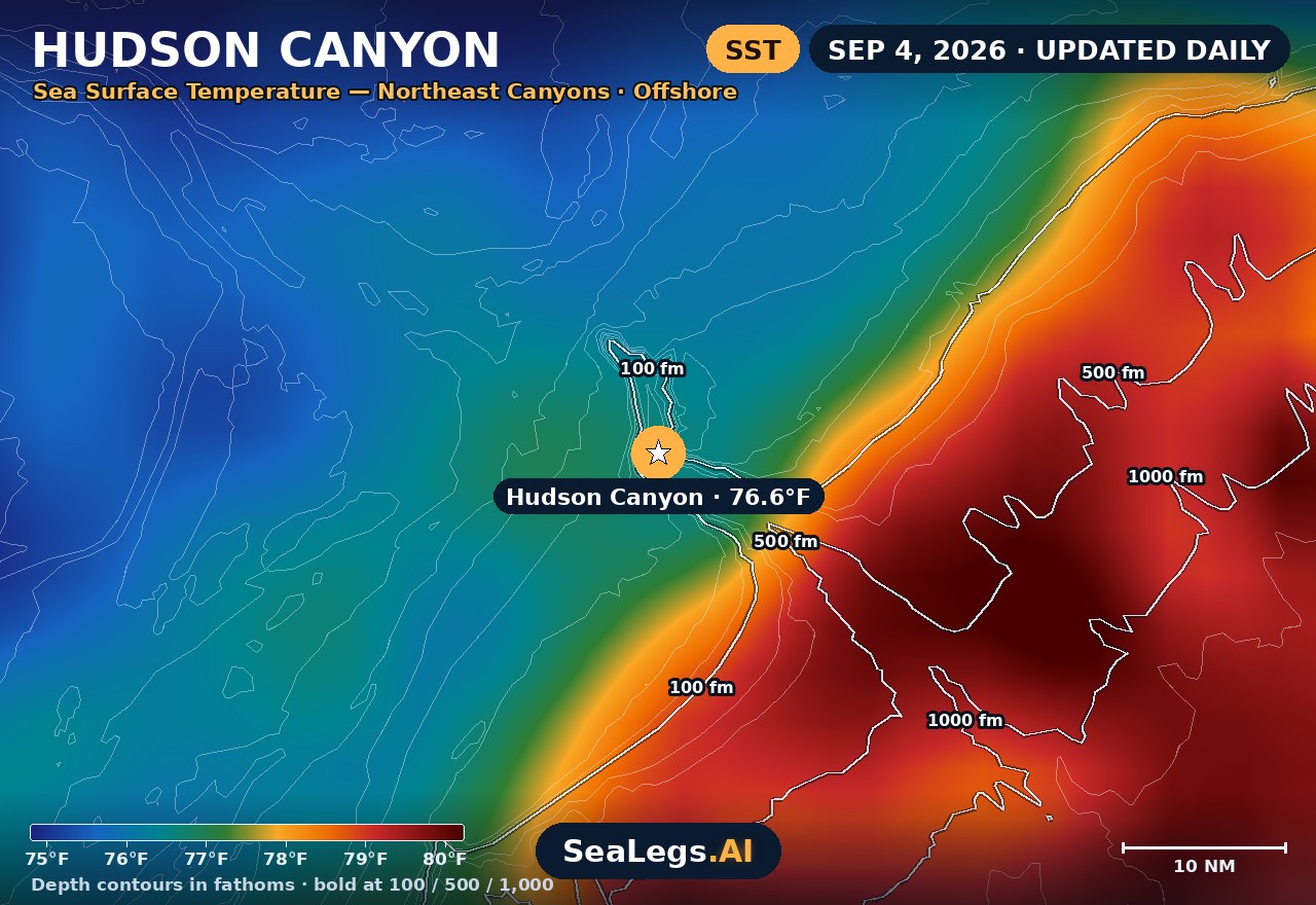
These charts show you the breaks. DeepCast reads them. A zone-by-zone AI fishing report for these exact waters — temperature edges, color changes, and structure, analyzed together.
Get the AI fishing reportSST and chlorophyll from the SeaLegs AI DeepCast satellite pipeline. Charts are a planning aid — always check the official marine forecast before making the run.
About Hudson Canyon
Hudson Canyon is the largest submarine canyon on the U.S. East Coast, roughly 70–100 nautical miles offshore of New York Harbor — a premier run for tuna, marlin, and mahi, and one of the longest offshore commitments in Northeast fishing. At that distance there is no ducking back in when the wind comes up, so the forecast below is built around the two things that decide a canyon trip: wind against current and swell period.
The outlook updates every morning from the latest marine model data, and each day gets an honest GO, CAUTION, or NO-GO call — the same AI rating used in the SeaLegs AI app.
Reading conditions at Hudson Canyon
The canyon sits at the edge of the continental shelf, where the bottom drops away and offshore swell arrives with nothing to soften it. Short-period seas that feel manageable at the inlet stack up steep and close over the shelf break, and a south or southwest blow against an ebbing current makes it worse. When you read the days below, weight the wave period as heavily as the height: 5 feet at 12 seconds can be a comfortable ride out, while 4 feet at 5 seconds is a punishing one.
Plan the whole window, not just the departure. A canyon day is commonly a 16–20 hour round trip — an overnight for the tuna bite — so a forecast that opens calm and builds through the afternoon can close the door on the ride home. The three-day view above is exactly for that call: pick the day the window stays open on both ends.
Hudson Canyon forecast FAQ
How is the sea at Hudson Canyon today?
As of Oct 19, 2026, the SeaLegs AI verdict for Hudson Canyon is NO-GO. NO-GO. Northeast winds of 19 to 26 knots with gusts to 36 knots, and east seas of 7 to 13 feet at 8-second periods. Winds ease only slightly in the early hours, then turn bad again from 2:00 PM onward. No settled stretch is long enough for a 12-hour trip.
How far offshore is Hudson Canyon?
Hudson Canyon lies roughly 70–100 nautical miles offshore of New York Harbor, at the edge of the continental shelf. Depending on your inlet and cruise speed, that's commonly a 4–6 hour run each way.
How often is this Hudson Canyon forecast updated?
The forecast on this page is rebuilt every morning from the latest marine model data, and the SpotCast card refreshes live in your browser. The date stamp above the outlook shows exactly when it was last generated.
What do GO, CAUTION, and NO-GO mean?
GO means conditions are favorable for most recreational offshore boats. CAUTION means marginal — manageable for experienced crews in capable vessels, but check the wind and wave timing closely. NO-GO means conditions are hazardous for small craft and the trip is best postponed.
Can I get a forecast like this for my own spot?
Yes. In the free SeaLegs AI app you can drop a pin on any spot on Earth — your inlet, a mid-shore lump, or another canyon — and get the same AI-rated marine forecast, plus fishing reports and trip planning.
What is the water temperature at Hudson Canyon today?
As of Oct 19, 2026, the satellite-derived sea surface temperature at Hudson Canyon is about 70.3°F, with chlorophyll around 0.29 mg/m³ (blue-green transition water). The SST and chlorophyll charts on this page are rebuilt every morning from the SeaLegs AI DeepCast satellite pipeline.
More offshore forecasts
Get this forecast for your own spot
Drop a pin on any spot on planet Earth in the free SeaLegs AI app — AI marine forecasts, fishing reports, and trip planning, rated GO / CAUTION / NO-GO.
📍 Get a Marine Forecast Near You →or download directly: