
AI-Powered
Marine Intelligence
Marine weather and fishing reports for your vessel, powered by AI that interprets weather models and satellite ocean data.


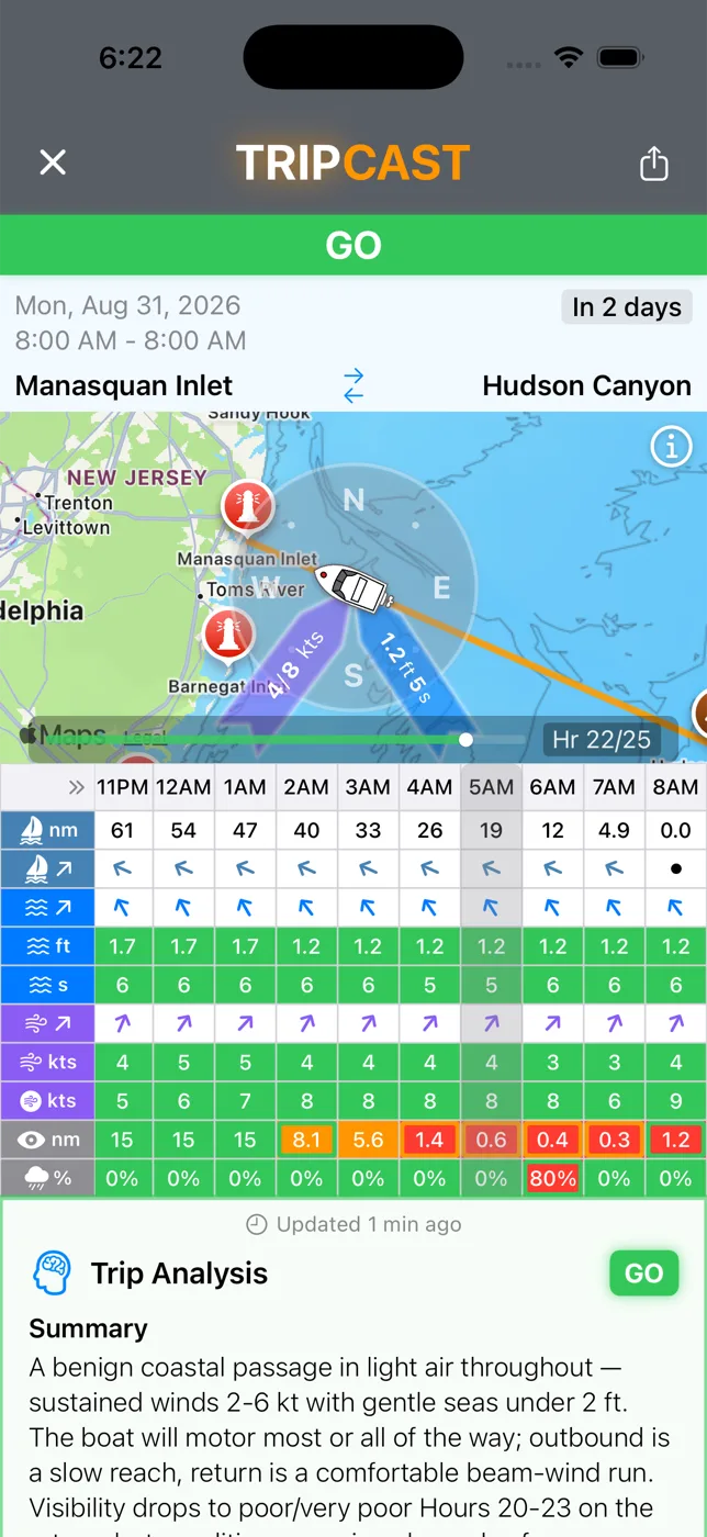


A verdict for your exact trip.
Pick a departure, a destination and a time. TripCast runs the route hour by hour against your vessel's size and limits, then hands you one word — and the reasoning behind it.
- Hour-by-hour conditions along your route
- Seas relative to your heading
- Confidence score for every forecast
- Alerts if the forecast turns
Know your spot up to 10 days out.
Drop a SpotCast on any inlet, reef or wreck and get a GO / CAUTION / NO-GO verdict for each day, up to 10 days out, with the wind and wave trend right on the card — so you can see a building sea before you feel it.
- Daily verdicts up to 10 days out
- Wind and wave trend for each day
- Best window each day, in plain English
- One tap to plan a TripCast

The fishing report an oceanographer would write.
Draw an analysis zone, pick your port, and DeepCast reads sea-surface temperature, chlorophyll, currents, eddies and bathymetry as one system — then explains the water: where the fronts are, why the bait is there, and which edges are worth the fuel, ranked.
- Inshore, midshore, offshore — top 5 spots
- Temp and color breaks, with coordinates
- Species and bait for the season
- Marine weather for the day, built in
- In-app and as a PDF

Someone watching, the whole way out and back.
Flip TripTracker on when you leave the dock. It follows your actual position against the plan and keeps re-running the forecast for the rest of your journey — where you are now and where you're headed — so if conditions turn while you're out on the water, you know before they reach you.
- Live position on your route
- Forecast re-run for the rest of the trip
- Alerts when conditions change
- Overdue and off-plan nudges
- Stops itself at the dock
The map everything else lives on.
Sea-surface temperature, chlorophyll, depth and thermocline, animated through the day, with currents, spots, inlets and your trips drawn on top. This is where a SpotCast, DeepCast or TripCast starts.
- SST · CHL · Depth · Thermocline, animated
- Inlets, reefs, wrecks, canyons, your spots
- Tap anything to cast on it

How it fits together
Everything runs off the same engine: your boat, the models, and the ocean as it is today.
Tell it about your boat
Length and type. Every verdict is tuned to that — a 19' skiff and a 40' sportfish don't get the same answer.
Pick where and when
Choose your departure and destination, then the date and time you plan to leave — or just pick a spot or draw an offshore zone. TripCast, SpotCast and DeepCast all start from a tap on the map.
Go, with company
Turn on TripTracker and the app keeps watching conditions and your position until you're back at the dock.
Free to download. Start with a TripCast.
Available on iPhone, iPad and Android. Upgrade to Plus or Pro when you want more casts and DeepCast reports.
Best AI Fishing & Weather Forecast · Kayak Angler, Best Fishing Apps 2026
 Scan with your phone
Get your SeaLegs before you go!
Questions? support@sealegs.ai