MidAtlantic TournamentMarine Weather — Cape May to the Canyons
The MidAtlantic Tournament 2027 runs Aug 16–21, 2027 out of Cape May, New Jersey. Here is the zone-by-zone conditions outlook in the lead-up to tournament week.


Tournament Location
Inshore at the inlet, midshore over the lumps, offshore at the canyon — the fleet fishes a wide band of water, so this page reads all three zones separately rather than giving one coastwide number. The live day-by-day GO / CAUTION / NO-GO cards are up top; here is the context and the latest one-line outlook for each.
Baltimore Canyon
OffshoreWhere the tournament is decided — Baltimore Canyon. Pan and zoom the chart, and switch layers to read the water.
Cape May Inlet
38.939, -74.869
The fleet's gateway between the Atlantic and Delaware Bay — where every tournament day starts and ends. Read the inlet against the tide before you commit to the run.
Calm Tue-Wed boating, Thursday needs careful timing
Tuesday all day is the top pick, with light 4-8 knots west winds and gentle 1.4-1.6 feet seas at 7-second periods from the ESE making for smooth, comfortable conditions.
Cape May Inlet — Tuesday, Sep 29 · GO
A great day on the water with light 4-8 knots west winds gusting to just 13 knots and easy 1.4-1.6 feet seas at 7-second periods from the ESE. Calm, well-organized conditions all day, any time works for a full trip.
Cape May Inlet — Wednesday, Sep 30 · GO
Another good day with light 3-11 knots southwest winds gusting to 16 knots and manageable 1.4-2.2 feet seas at 7-second periods from the ESE. Conditions stay favorable all day, giving plenty of flexibility to plan the full trip.
Cape May Inlet — Thursday, Oct 1 · CAUTION
Overall a workable day with 8-13 knots south-southwest winds gusting to 18 knots, but a steep wind-wave chop develops in the 1.8-2.6 feet seas at just 5-second periods from the southeast for about 3 hours. Plan around that choppier stretch rather than committing to it.
Jackspot / Lumps
38.550, -74.700
The mid-shelf lumps and bumps on the ride out, where bait stacks up and boats pick fish on the way to and from the canyon. The honest read on what the middle grounds are doing.
Great boating Tue-Wed, choppy Thursday afternoon caution
Tuesday 3:00 AM to 2:00 PM is the top pick, with light 5-6 knots WSW winds and gentle 2.3-2.4 feet seas at 7-second periods from the east for a smooth ride.
Jackspot / Lumps — Tuesday, Sep 29 · GO
A great day on the water with light 2-9 knots WSW winds (gusts 13 knots) and easy 1.9-2.4 feet seas at 7-second periods from the east. Calm, organized conditions and 10+nm visibility make any time good to head out.
Jackspot / Lumps — Wednesday, Sep 30 · GO
Another favorable day with light-to-moderate 1-12 knots SW winds (gusts 14 knots) and comfortable 2.0-2.5 feet seas at 8-second periods from the ESE. Well-spaced waves and clear 10+nm visibility make this a solid go-anytime day.
Jackspot / Lumps — Thursday, Oct 1 · CAUTION
Winds pick up to 11-17 knots SSW with gusts to 22 knots, and seas run 2.5-3.2 feet at a shorter 6-second period from the SE, creating steep, choppy wind-wave conditions for about 8 hours. Timing matters today—expect a rougher, less comfortable ride during that stretch, so plan carefully.
Baltimore Canyon
38.150, -73.850
The canyon edge where the tournament is won or lost — white and blue marlin, bigeye and yellowfin over the drop. Fully exposed, so weight swell period as heavily as height.
Great boating Tue-Wed; Thursday's chop calls for caution
Tuesday 7:00 AM to 6:00 PM is the pick, with light 7 knots west winds and organized 3.0 feet seas at 7-second periods from the east making for a smooth ride.
Baltimore Canyon — Tuesday, Sep 29 · GO
A great day on the water with light 6-9 knots west winds (gusts to 12 knots) and comfortable 2.5-3.3 feet seas at 7-second periods from the east. Clear visibility and no rain all day, any time works.
Baltimore Canyon — Wednesday, Sep 30 · GO
Another excellent day with gentle 3-9 knots west-southwest winds and well-organized 2.5-2.7 feet seas at 8-second periods from the east. Clear skies, calm conditions, and any hour is a good time to go.
Baltimore Canyon — Thursday, Oct 1 · CAUTION
Conditions start fine but deteriorate as SSW winds build to 16 knots (gusting 20 knots), creating steep wind-wave chop for several hours atop the 2.7-3.2 feet east-southeast swell. Part of the day brings a confused cross-sea where the ESE swell crosses the SSW wind-wave, making for awkward, uncomfortable motion. Careful timing is needed rather than treating the whole day as go.
Cape May Inlet tides
Every tournament day starts and ends at the inlet — read the run against the tide before you commit.
The AI fishing report for the Baltimore Canyon
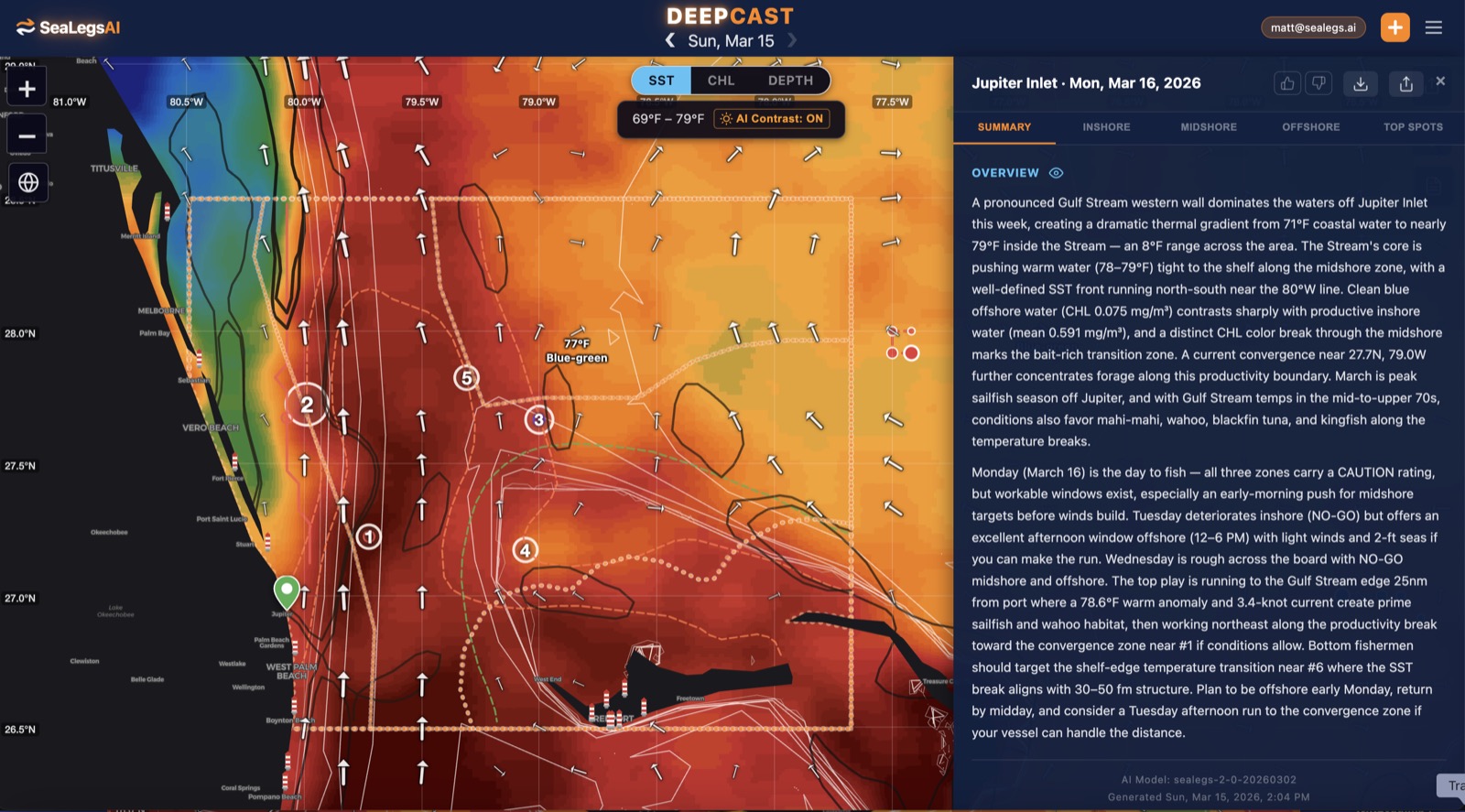
Weather tells you whether you can go. DeepCast reads the SST breaks, chlorophyll edges, and bottom structure for the exact waters the fleet fishes — inshore, midshore, and offshore — and turns them into a plain-English fishing report, the same AI reports built into the SeaLegs AI app.
Get the AI-powered fishing reportAbout the MidAtlantic Tournament
- DatesAug 16–21, 2027
- Host portCape May, New Jersey — Canyon Club Resort Marina
- The runOut Cape May Inlet to the Baltimore and Poor Man's canyons
- Target specieswhite and blue marlin, bigeye and yellowfin tuna, dolphin, and wahoo
The MidAtlantic Tournament is one of the richest big-game billfish tournaments on the East Coast, hosted out of the Canyon Club Resort Marina in Cape May, New Jersey — and Sunset Marina in Ocean City, Maryland, the tournament's second home port. Boats run out Cape May Inlet and push offshore to the Baltimore and Poor Man's canyons chasing white and blue marlin, bigeye and yellowfin tuna, dolphin, and wahoo.
Because the fleet fishes a wide band of water — from the inlet out to the canyon edge — this page reads conditions across three zones at once: inshore at the inlet, midshore over the lumps, and offshore at the canyon. Each zone gets a plain GO, CAUTION, or NO-GO call, updated every morning from the latest marine model data — the same AI rating used in the SeaLegs AI app.
Reading the run from Cape May to the canyons
The canyon run out of Cape May is a genuine offshore commitment — commonly 60–75 nautical miles each way to the Baltimore, with nowhere to duck in once you're past the shelf. That distance is why the three-zone read matters: a clean inlet and calm lumps at dawn say little about what the canyon edge is doing by afternoon. Weight swell period alongside height — a long-period 6-second-plus swell rides very differently from short, stacked wind chop at the same wave height, and warm-eddy edges where the fish set up are also where wind-against-current stands the sea up steep.
Plan the whole window, not just the departure. A tournament day is a long one, and a forecast that opens GO at the inlet can tighten to CAUTION offshore by the ride home. Pick the day the window stays open across all three zones on both ends of the trip. This page is a planning aid, not a substitute for the official NWS coastal waters forecast and marine warnings — always check those before you leave the dock.
MidAtlantic Tournament forecast FAQ
What are the marine conditions at the Mid-Atlantic canyons today?
As of Sep 29, 2026: Cape May Inlet — GO; Jackspot / The Lumps — GO; Baltimore Canyon — GO. Every rating is rebuilt each morning from the latest marine model data.
When and where is the MidAtlantic Tournament?
The MidAtlantic Tournament is a dual-port event based out of the Canyon Club Resort Marina in Cape May, New Jersey and Sunset Marina in Ocean City, Maryland, with the 2026 edition running August 16–21. Boats run out Cape May Inlet to the Baltimore and Poor Man's canyons in search of marlin, tuna, dolphin, and wahoo.
What's the run from Cape May to the canyons like?
It's a real offshore commitment — commonly 60 to 75 nautical miles each way to the Baltimore Canyon, with no shelter past the shelf. Conditions can differ sharply between the inlet, the mid-shelf lumps, and the canyon edge, which is why this page reads all three zones separately rather than giving one coastwide number.
How often is this forecast updated?
The three-zone board is rebuilt every morning from the latest marine model data, and each SpotCast card refreshes live in your browser. The date stamp above the outlook shows exactly when it was last generated.
What do GO, CAUTION, and NO-GO mean?
GO means conditions are favorable for most recreational offshore boats. CAUTION means marginal — manageable for experienced crews in capable vessels, but check the wind, swell period, and timing closely. NO-GO means conditions are hazardous for small craft and the trip is best postponed.
Can I get a forecast and fishing report for my own canyon numbers?
Yes. In the free SeaLegs AI app you can drop a pin on any spot on Earth — your own canyon numbers, a mid-shelf lump, or the inlet — and get the same AI-rated marine forecast, trip planning, and DeepCast AI fishing reports with SST breaks, chlorophyll edges, and structure.
More forecasts
Get this forecast for your own spot
Drop a pin on any spot on planet Earth in the free SeaLegs AI app — AI marine forecasts, fishing reports, and trip planning, rated GO / CAUTION / NO-GO.
📍 Get a Marine Forecast Near You →or download directly: