Islamorada Marine ForecastThe Hump
Updated Mon Oct 19, 2026
NO-GO: Steep NE chop and gusty winds all three days
Drop a pin on any spot in the world — free in the SeaLegs AI app.


Marine Forecast for Islamorada Hump Oct 19–21, 2026
📋 NO-GO: Steep NE chop and gusty winds all three days
NO-GO. Northeast seas of 5.5 to 6.8 feet at 7-second periods stack into steep wind-wave chop for 15 hours, with 17-20 knot east-northeast winds gusting to 29 knots. A 96% chance of rain around 11:00 AM adds to the misery. No settled stretch fits a 12-hour trip.
NO-GO. Steep wind-wave chop from the northeast, with seas of 5.6 to 6.3 feet at 7-second periods, persists for 10 hours. Northeast winds of 17-19 knots gust to 26 knots. Forecast confidence is low at 45%, and there is a 49% chance of rain around 8:00 AM. No time works for a 12-hour trip.
NO-GO. Northeast winds ease to 13-17 knots, gusting 24, and steep wind-wave chop lingers about 4 hours, mostly overnight. Seas of 3.6 to 5.5 feet at 6-second periods improve into the afternoon. Confidence is low at 48%, and no settled stretch covers a 12-hour trip.
No acceptable window exists for the 12-hour trip; Wednesday afternoon from 12:00 PM to 7:00 PM is only a partial lull, not a time to go.
Recent days at Islamorada Hump
Today’s Water at Islamorada Hump
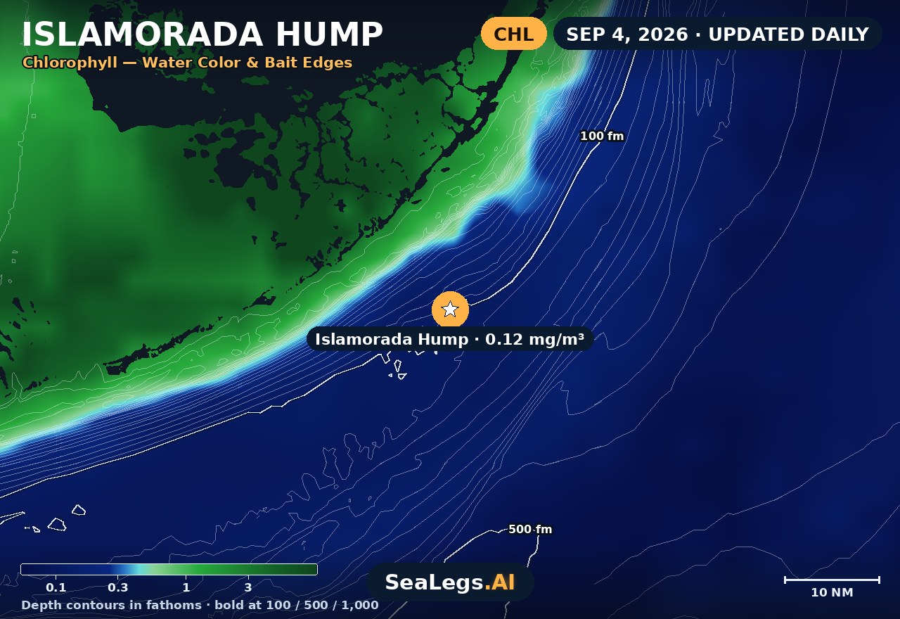
Sea surface temperature and chlorophyll around Islamorada Hump, imaged fresh every morning. Water at the star is 85.8°F today, and chlorophyll of 0.15 mg/m³ reads as blue-green transition water at the spot.
Imagery: Oct 19, 2026 · rebuilt every morning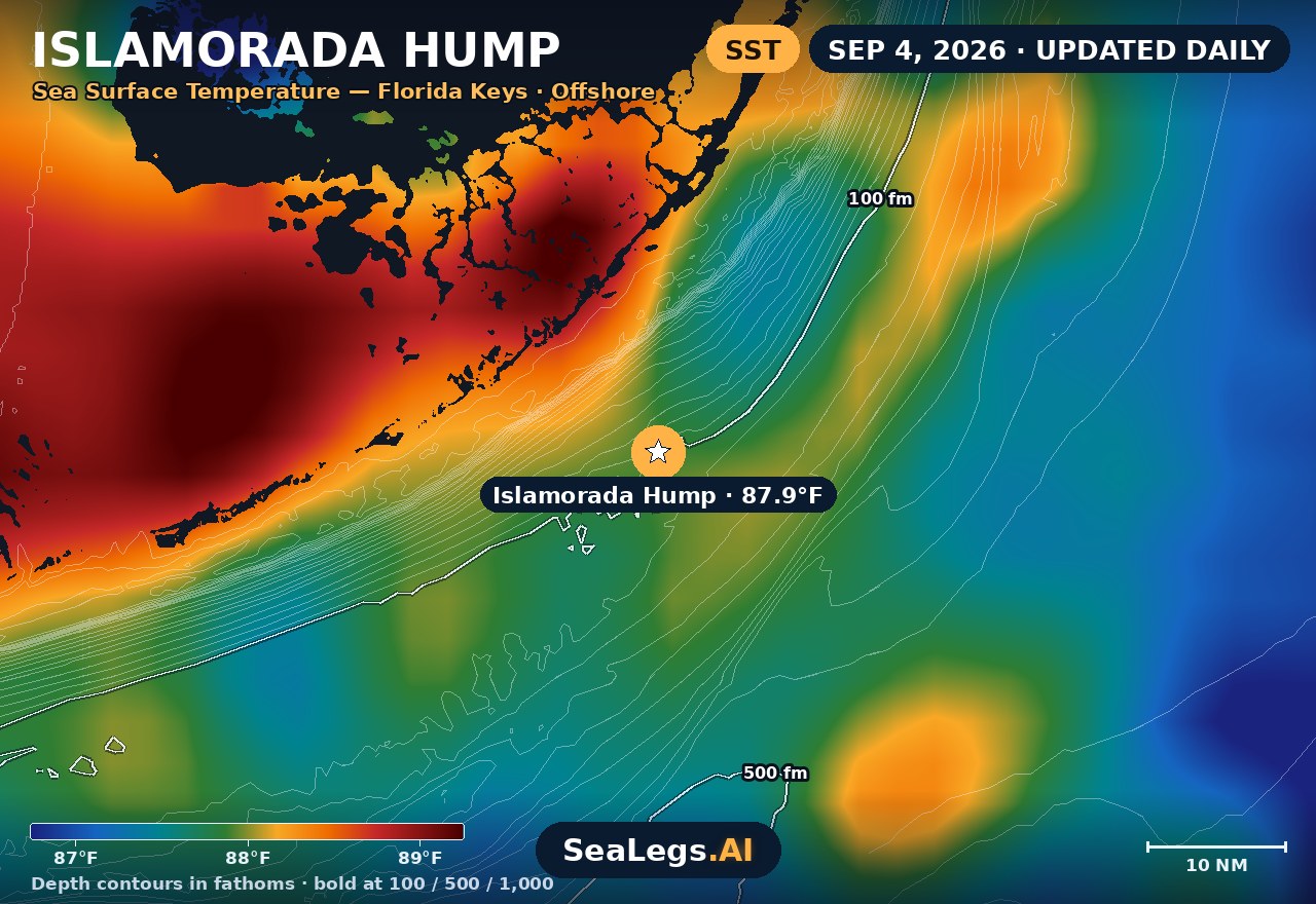
These charts show you the breaks. DeepCast reads them. A zone-by-zone AI fishing report for these exact waters — temperature edges, color changes, and structure, analyzed together.
Get the AI fishing reportSST and chlorophyll from the SeaLegs AI DeepCast satellite pipeline. Charts are a planning aid — always check the official marine forecast before making the run.
About the Islamorada Hump
“The Hump” off Islamorada is an underwater seamount that rises sharply into the Gulf Stream — the Florida Keys' signature offshore spot, stacking up blackfin tuna, amberjack, and pelagics where the current piles into the structure. Strong current over a steep bottom means sea state and wind direction make the difference between a comfortable troll and a rough, wet ride.
The outlook below updates every morning from the latest marine model data, with a plain GO / CAUTION / NO-GO call for each day — the same AI rating used in the SeaLegs AI app.
Reading conditions at the Islamorada Hump
The Hump's chop is current-made as much as wind-made. When a fresh breeze opposes the north-flowing Gulf Stream over the seamount, seas stand up steeper than the raw wave height suggests — so treat a wind-against-current day with more respect than the numbers alone would earn. Wind with the current, by contrast, can make a moderate forecast fish comfortably.
The run from Islamorada is short compared to a Northeast canyon trip, which makes the Hump forgiving on timing — but afternoon sea-breeze build is a daily rhythm in the Keys, and the calmest water is usually the early window. Check the day cards above for when each day's window opens and closes.
Islamorada Hump forecast FAQ
How is the sea at Islamorada Hump today?
As of Oct 19, 2026, the SeaLegs AI verdict for Islamorada Hump is NO-GO. NO-GO. Northeast seas of 5.5 to 6.8 feet at 7-second periods stack into steep wind-wave chop for 15 hours, with 17-20 knot east-northeast winds gusting to 29 knots. A 96% chance of rain around 11:00 AM adds to the misery. No settled stretch fits a 12-hour trip.
Where is the Islamorada Hump?
The Hump is an underwater seamount offshore of Islamorada in the Florida Keys, where the bottom rises steeply into the path of the Gulf Stream. The strong current over the structure concentrates bait and pelagic fish.
How often is this Islamorada forecast updated?
The forecast on this page is rebuilt every morning from the latest marine model data, and the SpotCast card refreshes live in your browser. The date stamp above the outlook shows when it was last generated.
What do GO, CAUTION, and NO-GO mean?
GO means conditions are favorable for most recreational boats. CAUTION means marginal — manageable for experienced crews, but check wind direction against the current before committing. NO-GO means conditions are hazardous for small craft and the trip is best postponed.
Can I get a forecast like this for my own spot?
Yes. In the free SeaLegs AI app you can drop a pin anywhere — a patch reef, a wreck, or your dock — and get the same AI-rated marine forecast, plus fishing reports and trip planning.
What is the water temperature at Islamorada Hump today?
As of Oct 19, 2026, the satellite-derived sea surface temperature at Islamorada Hump is about 85.8°F, with chlorophyll around 0.15 mg/m³ (blue-green transition water). The SST and chlorophyll charts on this page are rebuilt every morning from the SeaLegs AI DeepCast satellite pipeline.
More offshore forecasts
Get this forecast for your own spot
Drop a pin on any spot on planet Earth in the free SeaLegs AI app — AI marine forecasts, fishing reports, and trip planning, rated GO / CAUTION / NO-GO.
📍 Get a Marine Forecast Near You →or download directly: