Gulf of Mexico Offshore Marine Forecast
Updated Mon Oct 19, 2026
NO-GO: steep, choppy E seas all three days
Drop a pin on any spot in the world — free in the SeaLegs AI app.


Marine Forecast for FAD Buoy 1 Oct 19–21, 2026
📋 NO-GO: steep, choppy E seas all three days
No-go. East seas of 6-7 feet at 5-second periods are steep and choppy, with 17-20 knot east-northeast winds and gusts to 29 knots. Stay in port.
No-go. East seas of 4-5 feet at 4-second periods stay choppy until mid-afternoon, with 13-17 knot east-northeast winds. No window for a 12-hour trip.
No-go for a 12-hour trip. Winds ease to 11-15 knots from the east-northeast and east seas drop to about 3 feet at 4 seconds, best after 2:00 PM, but no long window.
Persistent east-northeast winds of 11-20 knots drive steep, short-period east seas of 3-7 feet at only 4-5 seconds across the whole forecast. Winds are mostly manageable, but the choppy seas make a full 12-hour trip uncomfortable or unsafe, and there is no settled all-GO stretch long enough for the trip on any day. Conditions slowly ease through Wednesday, but not enough to open a 12-hour window.
Recent days at FAD Buoy 1
Today’s Water at FAD Buoy 1
Sea surface temperature and chlorophyll around FAD Buoy 1, imaged fresh every morning. Water at the star is 81.1°F today, and chlorophyll of 0.2 mg/m³ reads as blue-green transition water at the spot.
Imagery: Oct 19, 2026 · rebuilt every morning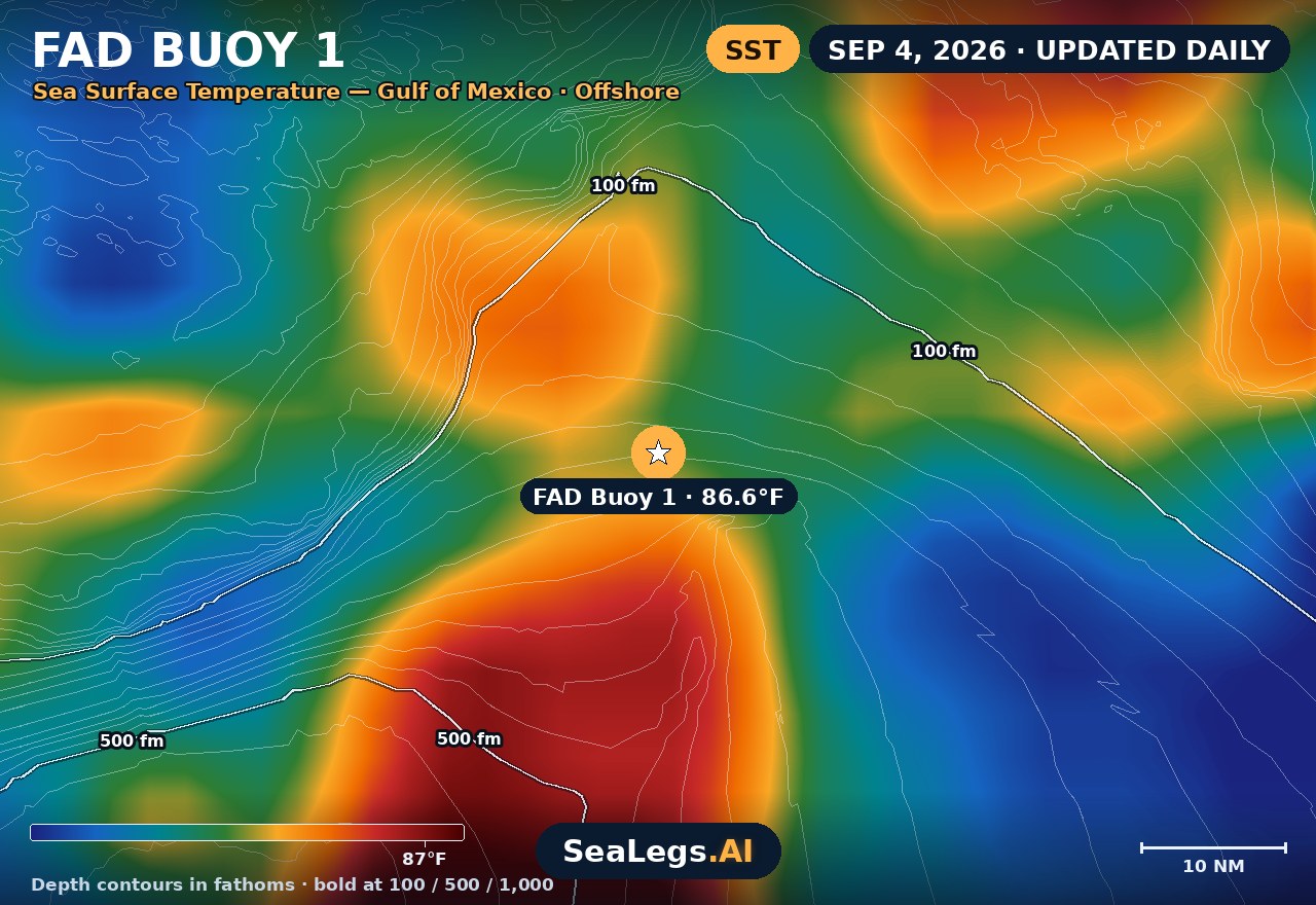
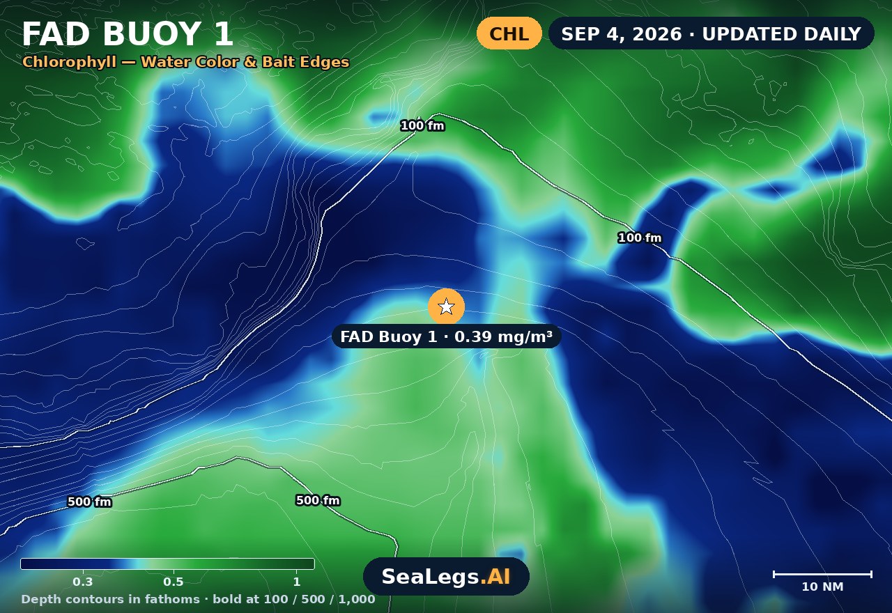
These charts show you the breaks. DeepCast reads them. A zone-by-zone AI fishing report for these exact waters — temperature edges, color changes, and structure, analyzed together.
Get the AI fishing reportSST and chlorophyll from the SeaLegs AI DeepCast satellite pipeline. Charts are a planning aid — always check the official marine forecast before making the run.
About this Gulf of Mexico forecast
This forecast tracks conditions at FAD Buoy 1, a fish aggregating device anchored in the open northern Gulf of Mexico that concentrates mahi-mahi, tuna, and wahoo around it. As a fixed open-water point well offshore, it is an honest read on what the open Gulf is actually doing — beyond the sea buoy, past the beach forecast, where conditions can shift fast.
The outlook below updates every morning from the latest marine model data, with a plain GO / CAUTION / NO-GO call for each day — the same AI rating used in the SeaLegs AI app.
Reading open-Gulf conditions
Gulf seas are typically shorter-period than open-Atlantic or Pacific swell — wind-driven chop that builds quickly when a breeze sets in and lays down almost as fast when it quits. That makes the Gulf less forgiving of a deteriorating afternoon than the raw wave heights suggest: 2 feet at 4 seconds is a wet, pounding ride in most center consoles. Watch the trend within each day on the cards above, not just the daily headline.
Summer patterns hinge on the sea breeze and afternoon thunderstorms; frontal season flips the Gulf rough for days at a time. When the outlook shows a building trend late in the day, plan to run early and be headed in before it arrives — the open Gulf gives you nowhere to hide.
FAD Buoy 1 forecast FAQ
How is the sea at FAD Buoy 1 today?
As of Oct 19, 2026, the SeaLegs AI verdict for FAD Buoy 1 is NO-GO. Unsafe seas make this a no-go day. East seas build to 6.7 feet at only 5-second periods, steep and choppy, all day long. Winds run 14-20 knots from the east and east-northeast with gusts up to 29 knots around 9:00 AM. Winds ease slightly from noon through the evening, but the seas stay far too rough for recreational vessels, and there is no window for a 12-hour trip. Stay in port.
What is a FAD, and why forecast one?
A FAD (fish aggregating device) is a buoy anchored in open water that concentrates pelagic fish like mahi-mahi, tuna, and wahoo. Because it sits at a fixed point well offshore, it doubles as a reliable reference for what open-Gulf conditions are really doing.
How often is this Gulf of Mexico forecast updated?
The forecast on this page is rebuilt every morning from the latest marine model data, and the SpotCast card refreshes live in your browser. The date stamp above the outlook shows when it was last generated.
What do GO, CAUTION, and NO-GO mean?
GO means conditions are favorable for most recreational boats. CAUTION means marginal — in the Gulf, pay special attention to the within-day trend and afternoon wind. NO-GO means conditions are hazardous for small craft and the trip is best postponed.
Can I get a forecast like this for my own spot?
Yes. In the free SeaLegs AI app you can drop a pin anywhere in the Gulf — a rig, a rip, or your favorite numbers — and get the same AI-rated marine forecast, plus fishing reports and trip planning.
What is the water temperature at FAD Buoy 1 today?
As of Oct 19, 2026, the satellite-derived sea surface temperature at FAD Buoy 1 is about 81.1°F, with chlorophyll around 0.2 mg/m³ (blue-green transition water). The SST and chlorophyll charts on this page are rebuilt every morning from the SeaLegs AI DeepCast satellite pipeline.
More offshore forecasts
Get this forecast for your own spot
Drop a pin on any spot on planet Earth in the free SeaLegs AI app — AI marine forecasts, fishing reports, and trip planning, rated GO / CAUTION / NO-GO.
📍 Get a Marine Forecast Near You →or download directly: