San Juan, Puerto Rico Marine Forecast
Updated Sun Oct 11, 2026
Easy 3-day run: light ESE winds, small seas
Drop a pin on any spot in the world — free in the SeaLegs AI app.


Marine Forecast for San Juan, PR Oct 11–13, 2026
📋 Easy 3-day run: light ESE winds, small seas
Good boating all day with 8-13 knots east-southeast winds (gusts to 21 knots) and 2-3 feet northeast seas at 5-second periods, a bit choppy but easy. There is a 74% chance of showers early in the day, so bring rain gear. Any time works for a 12-hour trip.
Another good day with 4-13 knots east-southeast winds, gusts to 20 knots, and 2-2.5 feet northeast seas at 5-second periods. Winds ease into the evening. There is a 65% chance of showers around 3:00 PM, so pack rain gear. Any time works for a 12-hour trip.
Favorable all day with 5-13 knots east winds, gusts to 21 knots, and 2-3 feet northeast seas at 6-second periods, slightly more organized. There is a 43% chance of showers around 3:00 PM, so bring rain gear. Any time works for a 12-hour trip.
Monday, October 12 from 7:00 PM through Tuesday morning is the pick, with calm 6 knots east-southeast winds and 2 feet northeast seas, though any time across the three days works for a 12-hour trip.
Recent days at San Juan, PR
Today’s Water at San Juan Harbor
Sea surface temperature and chlorophyll around San Juan Harbor, imaged fresh every morning. Water at the star is 84.6°F today, and chlorophyll of 0.64 mg/m³ reads as green shelf water at the spot.
Imagery: Oct 11, 2026 · rebuilt every morning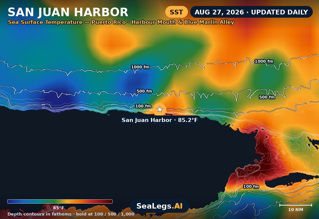
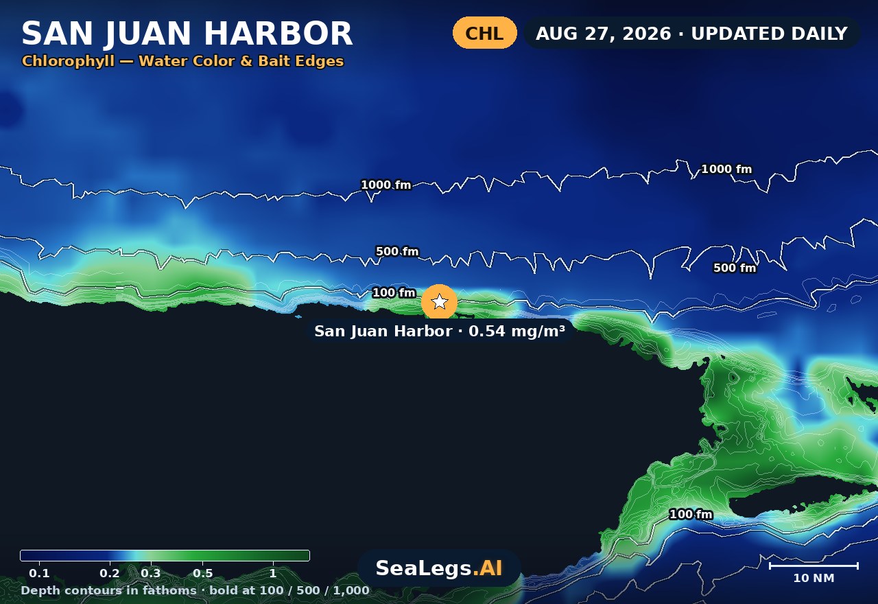
These charts show you the breaks. DeepCast reads them. A zone-by-zone AI fishing report for these exact waters — temperature edges, color changes, and structure, analyzed together.
Get the AI fishing reportSST and chlorophyll from the SeaLegs AI DeepCast satellite pipeline. Charts are a planning aid — always check the official marine forecast before making the run.
About San Juan
San Juan has the shortest run to deep water of any port on this site. Clear the harbour mouth under El Morro and the bottom falls away from around a hundred feet to several thousand inside a few miles — the Puerto Rico Trench sits just to the north and is the deepest water in the Atlantic. Boats are in blue water in well under an hour, which is why the offshore strip off this coast has its own name: Blue Marlin Alley.
That same geography is what makes a city forecast useless here. There is no shelf to take the energy out of an incoming swell, so what the open Atlantic is doing arrives at the harbour entrance almost undiluted. The outlook below updates every morning from the latest marine model data, and each day gets an honest GO, CAUTION, or NO-GO call — the same AI rating used in the SeaLegs AI app.
Reading conditions at San Juan
Read the swell before the wind. Puerto Rico's north coast faces the open Atlantic with almost no continental shelf in front of it, so a long-period north or northeast groundswell — often generated by a system thousands of miles away, under a clear local sky and a light breeze — lands on this coast at close to full strength. That is the reading that catches people out: height alone looks manageable, and the period is what tells you how it will behave in the harbour entrance. This is a winter-weighted pattern, building through November to March, which is the same window as the island's big-game tournament season.
Then read the trades. The prevailing easterly to northeasterly trade winds are the everyday driver, generally freshest through the middle of the day and lightest around dawn — the reason so many boats leave early. Trade-driven wind chop rides on top of whatever groundswell is already running, and the two stacking together in the entrance channel is a very different ride from either one alone.
The harbour itself is the shelter. Bahía de San Juan is a genuine deep-water bay behind a narrow entrance between El Morro and Isla de Cabras, so inside the bay stays workable in conditions that shut the outside down. Crossing that entrance is the decision point, not the distance offshore — and once you are past it there is no shallow water to duck into. Note also that Atlantic hurricane season runs through November 30, so a distant tropical system is a live consideration well into the autumn here.
San Juan, PR forecast FAQ
How is the sea at San Juan, PR today?
As of Oct 11, 2026, the SeaLegs AI verdict for San Juan, PR is GO. Good boating all day with 8-13 knots east-southeast winds (gusts to 21 knots) and 2-3 feet northeast seas at 5-second periods, a bit choppy but easy. There is a 74% chance of showers early in the day, so bring rain gear. Any time works for a 12-hour trip.
What marine forecast zone covers San Juan, Puerto Rico?
NOAA's coastal waters forecast for this stretch is AMZ712 — coastal waters of northern Puerto Rico out 10 nautical miles, issued by the National Weather Service office in San Juan. Beyond that you cross into AMZ711, the Atlantic waters of Puerto Rico and the USVI from 10 NM out. The forecast on this page is built for the harbour mouth itself rather than a whole zone, so it reflects the water you actually cross leaving and returning.
How far offshore is deep water at San Juan?
Very close. Depths drop from around a hundred feet to several thousand within roughly one and a half to five miles of the harbour entrance, and boats are commonly in water thousands of feet deep inside half an hour of leaving the dock. The Puerto Rico Trench to the north exceeds 27,000 feet, the deepest in the Atlantic Ocean.
What is Blue Marlin Alley?
It is the local name for the strip of deep water off San Juan and Puerto Rico's north coast, where the shelf drops away within a few miles of shore. The whole north coast is sometimes called Marlin Alley. It is the water the Club Náutico de San Juan International Billfish Tournament fleet fishes, and its productivity comes down to that abrupt drop-off sitting so close to a harbour.
When is the big-game season at San Juan?
Blue marlin are the headline fish and the season peaks in the late summer and autumn. Club Náutico de San Juan runs the International Billfish Tournament, billed as the longest consecutively held big-game fishing tournament in the world; the 73rd edition runs November 17 to 22, 2026, fishing on the 19th, 20th and 21st.
Why watch the harbour entrance separately from the general forecast?
Because there is effectively no shelf to soften anything. On coasts with a wide continental shelf, swell loses energy before it reaches the coast; here it does not. A San Juan city forecast describes the weather over the city, not the sea state in the entrance channel between El Morro and Isla de Cabras, and those two can tell very different stories on the same morning.
How often is this forecast updated?
The board is rebuilt every morning from the latest marine model data, and the card refreshes live in your browser. The date stamp above the outlook shows exactly when it was last generated.
What do GO, CAUTION, and NO-GO mean?
They are a plain-language read on whether conditions suit a typical recreational boat on that day, based on wind, wave height and wave period together rather than any single number. They are a planning aid, not a substitute for the official marine forecast and warnings — always check those, and your own vessel and experience, before you leave the dock.
What is the water temperature at San Juan Harbor today?
As of Oct 11, 2026, the satellite-derived sea surface temperature at San Juan Harbor is about 84.6°F, with chlorophyll around 0.64 mg/m³ (green shelf water). The SST and chlorophyll charts on this page are rebuilt every morning from the SeaLegs AI DeepCast satellite pipeline.
More offshore forecasts
Get this forecast for your own spot
Drop a pin on any spot on planet Earth in the free SeaLegs AI app — AI marine forecasts, fishing reports, and trip planning, rated GO / CAUTION / NO-GO.
📍 Get a Marine Forecast Near You →or download directly: