Napier Marine ForecastHawke Bay
Updated Tue Sep 29, 2026
Two solid GO days, then Thursday needs careful timing
Drop a pin on any spot in the world — free in the SeaLegs AI app.


Marine Forecast for Napier Sep 29 – Oct 1, 2026
📋 Two solid GO days, then Thursday needs careful timing
Great boating day with light 2-10 kt winds and comfortable 2-3 foot seas at long 7-11 second periods from the south/southeast. Best window is 4:00 PM-11:00 PM when winds go nearly calm. High confidence overall.
Calm, easy day with 1-9 kt winds and steady 2 foot seas at 8-10 second periods from the SSE. Good anytime, though gust forecasts carry some uncertainty. One of the best days of the week.
Mixed day: calm mornings (4-10 kt NW winds, 2 foot seas) give way to building afternoon winds to 13 kt with gusts near 24 kt. Low model confidence adds uncertainty. Best to go early or wait for the evening easing after 5 PM.
Tuesday and Wednesday offer light winds and comfortable, well-organized seas, making them the pick of the week for boating. Thursday starts calm but afternoon westerlies build with stronger gusts and lower confidence in the models, so it lands as a caution day rather than a clean go.
Recent days at Napier
Today’s Water at Napier
Sea surface temperature and chlorophyll around Napier, imaged fresh every morning. Water at the star is 55.4°F today, and chlorophyll of 2.43 mg/m³ reads as nutrient-rich green water at the spot.
Imagery: Sep 29, 2026 · rebuilt every morning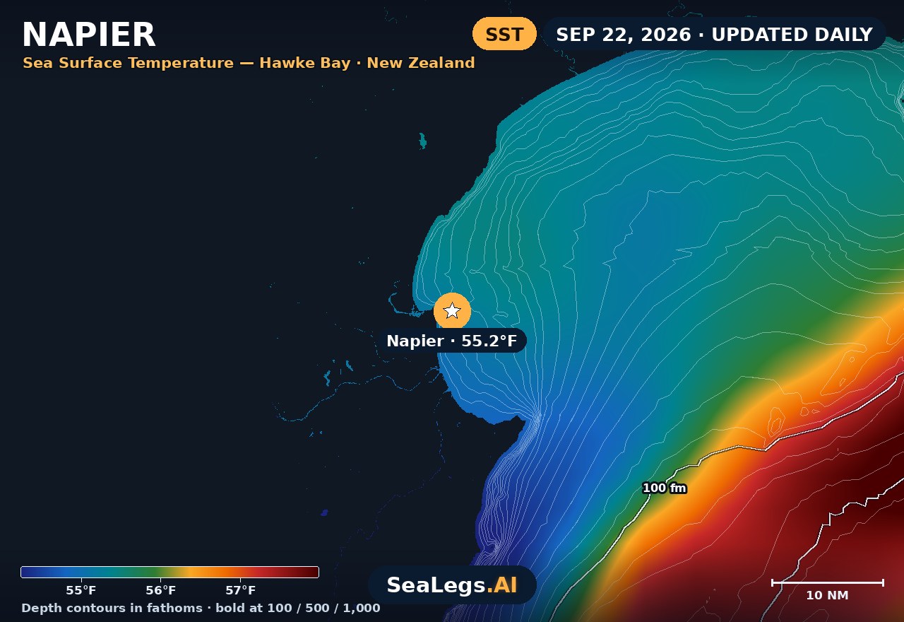
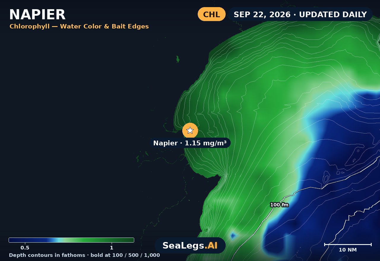
These charts show you the breaks. DeepCast reads them. A zone-by-zone AI fishing report for these exact waters — temperature edges, color changes, and structure, analyzed together.
Get the AI fishing reportSST and chlorophyll from the SeaLegs AI DeepCast satellite pipeline. Charts are a planning aid — always check the official marine forecast before making the run.
About Napier
Napier sits on the open western shore of Hawke Bay, and every trip out of the port or Ahuriri marina means crossing exposed water to reach the grounds — snapper and gurnard on the closer sand and foul, kingfish holding on structure like Pania Reef. This is a genuine open-bay run, not a sheltered harbour, so the forecast below is built around the one thing that decides most Napier days: how much easterly swell is standing in the bay.
Hawke Bay faces east and southeast, wide open to swell that can build fast off the ocean, while an offshore westerly land breeze will flatten it right down. The 3-day widget weighs swell height and period against wind speed and direction and gives you a plain GO / CAUTION / NO-GO read for each day — the same AI rating used in the SeaLegs AI app.
Reading conditions at Napier
Start with swell direction and period, not just height. An easterly or southeasterly swell rolls straight into Hawke Bay with nothing to block it, and a long-period groundswell that reads "only 1.5m" offshore can still stack up into a lumpy, tiring ride across the bay and dangerous water over Pania Reef. A short-period wind-chop from a fresh onshore is uncomfortable but more predictable; a long-period easterly swell is what turns a marginal day into a NO-GO.
Wind direction is the other half of the picture. A westerly or southwesterly blows offshore here and knocks the sea flat — often the best window is early, before the daytime sea breeze swings onshore and stands the chop up against any leftover swell. Watch for wind against swell: a rising southeasterly over an existing easterly sea builds steep, close-spaced faces quickly. Time your crossing for the calm early hours, keep an eye on the afternoon breeze, and give Pania and the reef edges room when there's any east in the water.
Napier forecast FAQ
How is the sea at Napier today?
As of Sep 29, 2026, the SeaLegs AI verdict for Napier is GO. A strong GO day with light WNW-to-NE winds mostly 2-10 kt (gusts up to 21 kt overnight easing through the day) and gentle 1.8-3.0 foot seas at 7-to-11 second periods from the south to southeast - well-organized, comfortable swell throughout. The best window is the evening from 4:00 PM to 11:00 PM when winds drop to near calm (2-8 kt) and seas settle to 1.9-2.1 feet at 9-11 second periods, making this the standout stretch of the whole forecast. Model confidence is good at 79%, though wave period shows some divergence later in the day - not a concern for the favorable verdict.
Where is the Napier marine forecast for?
This forecast covers Hawke Bay off Napier on the east coast of New Zealand's North Island — the open water boaters cross from Napier Port and Ahuriri marina to reach the grounds. That includes the inshore snapper and gurnard sand, the foul closer to town, and marks like Pania Reef where kingfish hold on structure. Hawke Bay is open to the ocean on its eastern side, so conditions are driven by easterly and southeasterly swell rather than the shelter you'd get inside a harbour.
How accurate is this Napier marine forecast?
The outlook is generated from the latest marine model data and rated GO, CAUTION, or NO-GO by the same AI engine used in the SeaLegs AI app. It's a planning aid, not a substitute for the official MetService marine forecast and any current warnings — always check those before heading out.
How often is this forecast updated?
The page is rebuilt every morning from the latest model run, and the SpotCast card refreshes live in your browser. The date stamp above the outlook shows exactly when it was last generated.
What do GO, CAUTION, and NO-GO mean?
GO means conditions are favourable for most recreational boats. CAUTION means marginal — manageable for experienced crews in capable vessels, but check the wind and sea timing closely. NO-GO means conditions are hazardous for small craft and the trip is best postponed.
Can I get a forecast like this for my own spot?
Yes. In the free SeaLegs AI app you can drop a pin anywhere on Earth — your local ramp, a favourite mark, or a spot well offshore — and get the same AI-rated marine forecast and trip planning.
What is the water temperature at Napier today?
As of Sep 29, 2026, the satellite-derived sea surface temperature at Napier is about 55.4°F, with chlorophyll around 2.43 mg/m³ (nutrient-rich green water). The SST and chlorophyll charts on this page are rebuilt every morning from the SeaLegs AI DeepCast satellite pipeline.
More offshore forecasts
Get this forecast for your own spot
Drop a pin on any spot on planet Earth in the free SeaLegs AI app — AI marine forecasts, fishing reports, and trip planning, rated GO / CAUTION / NO-GO.
📍 Get a Marine Forecast Near You →or download directly: