Port Phillip Bay Marine Forecast
Updated Tue Sep 29, 2026
It depends on the day — best conditions land Thursday
Drop a pin on any spot in the world — free in the SeaLegs AI app.


Marine Forecast for Port Phillip Bay Sep 29 – Oct 1, 2026
📋 It depends on the day — best conditions land Thursday
Calm early with light NNE winds and small seas, but afternoon brings steeper, short-period wind-driven chop up to 2.4 feet with gusts to 22 knots. Best conditions are before mid-morning; use caution later in the day.
Rough and unsafe through midday with 17-22 knot northerly winds gusting to 30 knots and steep 3-second-period seas to 3.5 feet. Conditions settle from about 1:00 PM onward with lighter winds and smaller seas, opening a solid window into Thursday - avoid departing before early afternoon.
The best day of the forecast: light 4-12 knot winds and seas under 1.6 feet with comfortable 5-7 second periods at midday. Good conditions hold essentially all day, making Thursday the easy choice for a full trip.
This three-day stretch is a mixed bag: Tuesday looks solid but picks up a few hours of steeper wind-driven chop late in the day, Wednesday sees a strong northerly blow with only a settled window starting Wednesday afternoon into Thursday, and Thursday itself is the clear pick with light winds and small, well-organized seas all day.
Recent days at Port Phillip Bay
Today’s Water at Port Phillip Bay
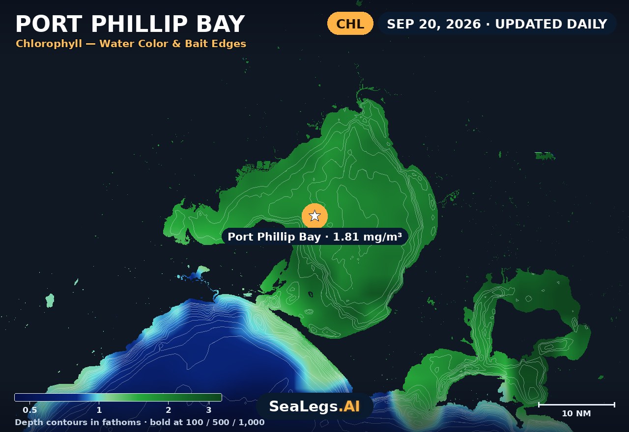
Sea surface temperature and chlorophyll around Port Phillip Bay, imaged fresh every morning. Water at the star is 57.2°F today, and chlorophyll of 1.81 mg/m³ reads as nutrient-rich green water at the spot.
Imagery: Sep 29, 2026 · rebuilt every morning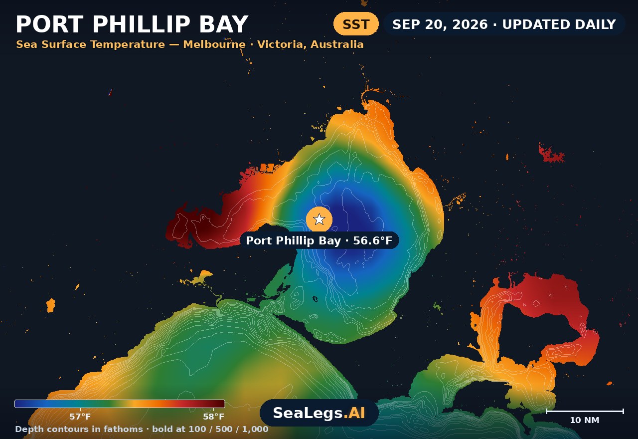
These charts show you the breaks. DeepCast reads them. A zone-by-zone AI fishing report for these exact waters — temperature edges, color changes, and structure, analyzed together.
Get the AI fishing reportSST and chlorophyll from the SeaLegs AI DeepCast satellite pipeline. Charts are a planning aid — always check the official marine forecast before making the run.
About Port Phillip Bay
Port Phillip Bay is a big enclosed sheet of water, and that changes everything about how you read it. There's no ocean swell rolling in here — the sea state is wind-driven chop, and the bay's short fetch means it stands up steep and nasty the moment the breeze pipes up. A morning glass-off can become a genuinely uncomfortable ride home by early afternoon when the sea breeze fills in.
This page updates daily with a 3-day outlook built around what actually matters in the bay: wind strength and direction, how the chop will build through the day, and when the water lays down. Each day gets a plain GO / CAUTION / NO-GO rating — the same AI rating used in the SeaLegs AI app.
Reading conditions in Port Phillip Bay
Watch the wind, not the swell. The bay's limited fetch means chop builds fast and steep — a 15-knot southerly that would barely register offshore will have the bay standing up short and sharp within an hour, especially over the shallower northern flats off Melbourne and St Kilda. The classic trap is the afternoon sea breeze and the southerly change: a calm, fishable morning flips to a wet, banging slog once the change comes through, so plan your run home around it rather than the dawn conditions.
The other hard rule is the entrance. The Rip at Port Phillip Heads, between Point Lonsdale and Point Nepean, is one of the most dangerous stretches of water in the country — the tidal flow through the narrow gap stacks against wind and ocean swell into standing, breaking water that has killed experienced crews. It's only safe on the right tide (slack water) and the right wind, and this bay forecast does not cover conditions in the Rip itself. If you're heading out through the Heads, treat that passage as a separate, serious decision.
Port Phillip Bay forecast FAQ
How is the sea at Port Phillip Bay today?
As of Sep 29, 2026, the SeaLegs AI verdict for Port Phillip Bay is CAUTION. Tuesday starts calm with light 3-9 knot NNE-NE winds and tiny 0.7-1.1 feet seas at 3-5 second periods through the early morning, but conditions firm up by mid-morning as winds build into the 13-16 knot NNE range with gusts to 22 knots. During the afternoon and evening a steeper wind-driven chop develops, with seas reaching 1.8-2.4 feet at only 2-3 second periods - short and choppy rather than smoothly organized, which is why a few hours require extra caution even though the wind itself stays in the moderate range. Plan around the steeper chop window and favor the calmer early morning hours for the smoothest ride.
When is the best time to fish Port Phillip Bay for snapper?
The famous snapper run fires up through spring and into summer, roughly October to December, when the reds move into the bay in numbers. On the water, the fish and the boating both favour the settled window before the afternoon sea breeze fills in — light early winds and a tide change are the classic combination. Whiting and squid hold through the warmer months too. Always check the daily GO / CAUTION / NO-GO rating before you commit: a good snapper tide isn't worth much if a southerly change is going to turn the bay into steep chop before you're back at the ramp.
How accurate is this Port Phillip Bay marine forecast?
The outlook is generated from the latest marine model data and rated GO, CAUTION, or NO-GO by the same AI engine used in the SeaLegs AI app. It's a planning aid, not a substitute for the official Bureau of Meteorology (BoM) marine forecast and any current warnings — always check those before heading out.
How often is this forecast updated?
The page is rebuilt every morning from the latest model run, and the SpotCast card refreshes live in your browser. The date stamp above the outlook shows exactly when it was last generated.
What do GO, CAUTION, and NO-GO mean?
GO means conditions are favourable for most recreational boats. CAUTION means marginal — manageable for experienced crews in capable vessels, but check the wind and sea timing closely. NO-GO means conditions are hazardous for small craft and the trip is best postponed.
Can I get a forecast like this for my own spot?
Yes. In the free SeaLegs AI app you can drop a pin anywhere on Earth — your local ramp, a favourite mark, or a spot well offshore — and get the same AI-rated marine forecast and trip planning.
What is the water temperature at Port Phillip Bay today?
As of Sep 29, 2026, the satellite-derived sea surface temperature at Port Phillip Bay is about 57.2°F, with chlorophyll around 1.81 mg/m³ (nutrient-rich green water). The SST and chlorophyll charts on this page are rebuilt every morning from the SeaLegs AI DeepCast satellite pipeline.
More offshore forecasts
Get this forecast for your own spot
Drop a pin on any spot on planet Earth in the free SeaLegs AI app — AI marine forecasts, fishing reports, and trip planning, rated GO / CAUTION / NO-GO.
📍 Get a Marine Forecast Near You →or download directly: