Hervey Bay Marine Forecast
Updated Tue Sep 29, 2026
Three straight GO days with calm winds and small, choppy-but-manageable seas
Drop a pin on any spot in the world — free in the SeaLegs AI app.


Marine Forecast for Hervey Bay Sep 29 – Oct 1, 2026
📋 Three straight GO days with calm winds and small, choppy-but-manageable seas
GO day with light 6-15 knots SE winds building through the afternoon (gusts to 25 knots between noon and 6 PM). Seas stay small at 1-2 feet but short 2-second periods make them a bit choppy. Morning before 10 AM is the calmest window.
Best day of the three - GO with light 5-11 knots SE/ESE winds and seas under 1.7 feet, easing further to under 1 foot by evening. Comfortable and easy conditions all day, especially the afternoon-into-evening window.
GO day with light 5-11 knots ESE winds easing to just 3-7 knots by evening. Seas remain small at 0.7-1.3 feet all day - a comfortable, easy outing with the calmest conditions after 6 PM.
All three days offer safe boating conditions with light-to-moderate winds and small wave heights, though the short 2-second wave periods keep the seas a bit bouncy rather than smooth. Wednesday stands out as the calmest day with the lightest winds and smallest seas, while Tuesday sees a bit more breeze in the afternoon.
Recent days at Hervey Bay
Today’s Water at Hervey Bay
Sea surface temperature and chlorophyll around Hervey Bay, imaged fresh every morning. Water at the star is 72.3°F today, and chlorophyll of 0.75 mg/m³ reads as green shelf water at the spot.
Imagery: Sep 29, 2026 · rebuilt every morning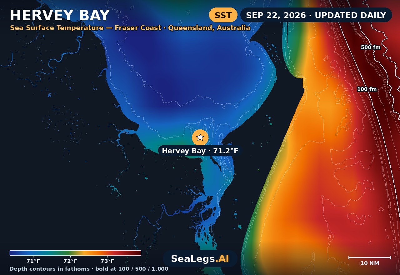
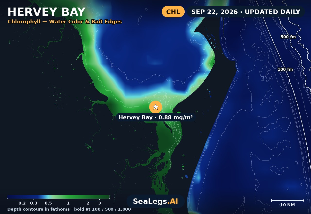
These charts show you the breaks. DeepCast reads them. A zone-by-zone AI fishing report for these exact waters — temperature edges, color changes, and structure, analyzed together.
Get the AI fishing reportSST and chlorophyll from the SeaLegs AI DeepCast satellite pipeline. Charts are a planning aid — always check the official marine forecast before making the run.
About Hervey Bay
Hervey Bay sits in the lee of K'gari (Fraser Island), the world's largest sand island, which walls off the Coral Sea swell before it ever reaches the water. That shelter is the whole story here: on most days the bay is flat, protected boating, and the sea state you actually feel is locally-generated wind-chop, not ocean groundswell. It's why the bay works as a humpback nursery from July to November, and why a run north to Platypus Bay for flathead, snapper, golden trevally or school mackerel is so often on.
The daily forecast below tracks the two things that decide a Hervey Bay day — wind over the shallow flats and the state of the tide — and rolls the next three days into a single call: GO / CAUTION / NO-GO, the same AI rating used in the SeaLegs AI app.
Reading conditions in Hervey Bay
Because Fraser Island blocks the swell, don't read Hervey Bay like an open-coast spot — wind strength and direction, not swell period, make the call. A southeasterly is largely blocked by the island and the mainland, so the bay stays workable in a fresh SE that would shut down the open ocean. The chop that does build is short-period wind-wave over shallow water, so it stacks up fast when the breeze gets against a running tide, then lies down almost as quickly once the wind eases.
The exception is the north. Platypus Bay opens to the top of Fraser Island, so a strong northerly has a long fetch straight down onto the flats and can turn a "sheltered" bay lumpy and uncomfortable, especially on a wind-against-tide push. Watch the tide over the shallows too: big run-out tides drain the sand flats and expose ground you were floating over an hour earlier. Plan launches, the Platypus Bay run and whale-watching trips around a northerly change and the tide, and the shelter does the rest.
Hervey Bay forecast FAQ
How is the sea at Hervey Bay today?
As of Sep 29, 2026, the SeaLegs AI verdict for Hervey Bay is GO. Tuesday is a GO day with light-to-moderate 6-15 knots southeast winds throughout, building from a calm 6 knots overnight to a peak of 14-15 knots SE with gusts to 25 knots during the afternoon hours between 12:00 PM and 6:00 PM. Seas stay small at 1.0-2.0 feet from the southeast/east-southeast, but the short 2-second period keeps things a bit choppy rather than smooth, especially during the windier afternoon stretch. Morning hours before 10:00 AM offer the gentlest combination of wind and wave for those wanting the calmest ride.
Is Hervey Bay usually calm enough for boating?
Yes — more than most open-coast waters. K'gari (Fraser Island) blocks the ocean swell, so Hervey Bay is protected and calm much of the time, and the sea state is mostly local wind-chop rather than groundswell. The days to watch are strong northerlies, which have open fetch down Platypus Bay, and wind blowing against a running tide over the shallow flats.
How accurate is this Hervey Bay marine forecast?
The outlook is generated from the latest marine model data and rated GO, CAUTION, or NO-GO by the same AI engine used in the SeaLegs AI app. It's a planning aid, not a substitute for the official Bureau of Meteorology (BoM) marine forecast and any current warnings — always check those before heading out.
How often is this forecast updated?
The page is rebuilt every morning from the latest model run, and the SpotCast card refreshes live in your browser. The date stamp above the outlook shows exactly when it was last generated.
What do GO, CAUTION, and NO-GO mean?
GO means conditions are favourable for most recreational boats. CAUTION means marginal — manageable for experienced crews in capable vessels, but check the wind and sea timing closely. NO-GO means conditions are hazardous for small craft and the trip is best postponed.
Can I get a forecast like this for my own spot?
Yes. In the free SeaLegs AI app you can drop a pin anywhere on Earth — your local ramp, a favourite mark, or a spot well offshore — and get the same AI-rated marine forecast and trip planning.
What is the water temperature at Hervey Bay today?
As of Sep 29, 2026, the satellite-derived sea surface temperature at Hervey Bay is about 72.3°F, with chlorophyll around 0.75 mg/m³ (green shelf water). The SST and chlorophyll charts on this page are rebuilt every morning from the SeaLegs AI DeepCast satellite pipeline.
More offshore forecasts
Get this forecast for your own spot
Drop a pin on any spot on planet Earth in the free SeaLegs AI app — AI marine forecasts, fishing reports, and trip planning, rated GO / CAUTION / NO-GO.
📍 Get a Marine Forecast Near You →or download directly: